

WingtraRAY
A Swiss vertical-takeoff mapping wing that Wingtra rates at 59 minutes and 550 hectares a flight. On the Blue UAS list, which is what lets it be sold new in the US. No thermal sensor.
- Weight
- 5.2 kg max takeoff
- Flight time
- 59 min (45 min with LIDAR)
- Price
- $23,100
- Made by
- Wingtra
Where to buyWingtra partners, $23,100 without a sensor; quotes
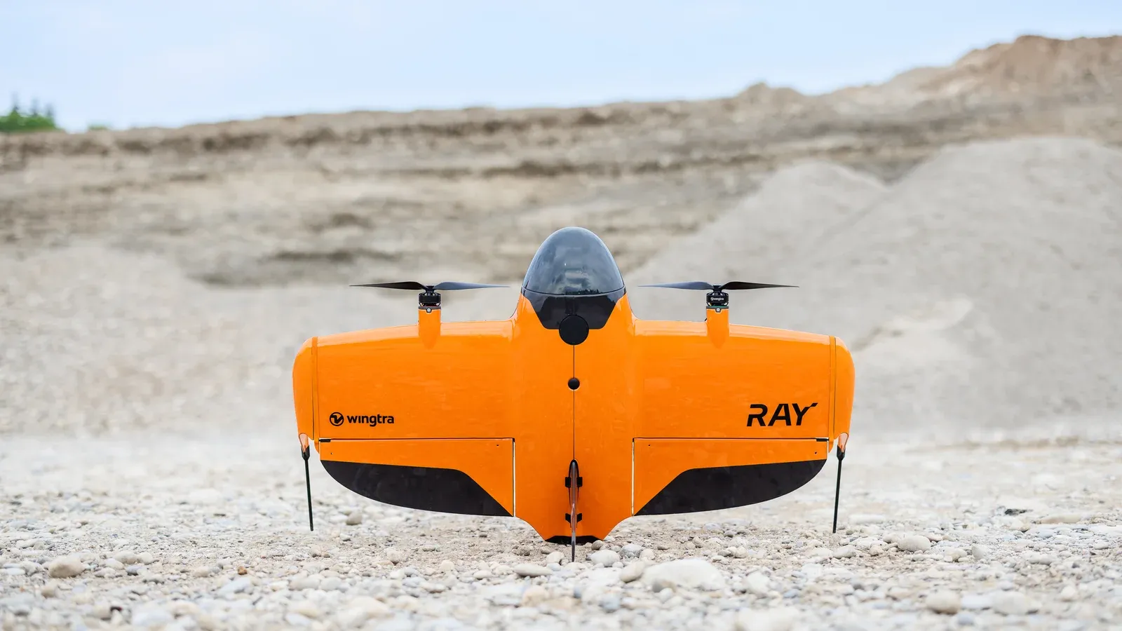
The WingtraRAY is a vertical-takeoff fixed-wing drone for surveying and mapping, made by Wingtra of Zurich. It takes off and lands standing on its tail, then flies its survey lines as a wing: up to 59 minutes and 550 hectares in one flight with the 61 MP MAP61 camera, by Wingtra’s figures. AllTerra Central, a Texas dealer on Wingtra’s partner list, sells the drone bundle for $23,100 before a sensor.
Wingtra says the WingtraRAY replaced the WingtraOne Gen II, its flagship from 2017 to 2025. It is bought by surveyors, engineers and GIS teams mapping large sites, and in the US by public agencies and contractors that must buy from the Pentagon’s Blue UAS list.
Aircraft Specifications
| Specification | WingtraRAY |
|---|---|
| Type | Tailsitter VTOL fixed-wing |
| Max takeoff weight | 5.2 kg |
| Payload capacity | 1,250 g |
| Wingspan | 125 cm |
| Dimensions | 125 × 68 × 12 cm, without landing fin |
| Transport case | 130 × 70 × 34 cm; 14.4 kg with the drone bundle |
| Max flight time | 59 min with MAP61, SURVEY61, INSPECT, SURVEY24 or RedEdge-P; 45 min with LIDAR |
| Cruise speed | Adaptive, 16 to 22 m/s |
| Climb / sink | 8 / 8 m/s in cruise; 6 / 2.5 m/s in hover |
| Wind | 12 m/s sustained at cruise height, gusts to 18 m/s; do not fly above 8 m/s measured on the ground |
| Operating temperature | −10 °C to 40 °C |
| Altitude | 4,800 m takeoff, 5,000 m flight above sea level, with high-altitude propellers |
| Ingress protection | IP53; not recommended in fog, rain or snow |
| Batteries | Two 99 Wh lithium-polymer packs, flown as a pair; 525 g each; one hour to charge a pair |
| Radio | 2.4 GHz telemetry, 10 km in line of sight; LTE as a fallback |
| GNSS | GPS, GLONASS, Galileo and BeiDou; PPK on every aircraft |
| Obstacle avoidance | Forward 60–64 GHz radar for static obstacles 100 m ahead in cruise; “available in beta” |
| Parachute | Optional add-on; automatic or manual deployment, minimum 45 m |
All figures are Wingtra’s published specifications, from its WingtraRAY page and its technical specification sheet (version 2.7, February 2026), read on 9 October 2026. FlightBrief has not flown the aircraft. The web page gives no empty weight; the 5.2 kg is from the sheet.
The radar has limits Wingtra spells out. Its sheet says buildings, cranes, towers and rock faces are likely to be detected, vegetation and thin wires such as power lines are not, and detection “is not guaranteed for any type of object”.
Sensors
| Sensor | Type | Resolution at 120 m | Max coverage at 120 m |
|---|---|---|---|
| MAP61 | 61 MP full frame, 17 mm, oblique mount | 2.7 cm/px | 550 ha |
| SURVEY61 | 61 MP full frame, 35 mm, leaf shutter | 1.3 cm/px | 270 ha |
| INSPECT | 61 MP full frame, 85 mm | 0.5 cm/px | 80 ha |
| SURVEY24 | 24 MP APS-C, 20 mm | 2.4 cm/px | 330 ha |
| LIDAR | Hesai XT32M2X scanner, 1,060 g | About 84 points/m² on hard surfaces | 460 ha at 90 m |
| RedEdge-P | Five-band multispectral plus panchromatic, 456 g | 4.0 cm/px | 180 ha |
Coverage assumes 60% side overlap for the cameras, 30% for the LIDAR and 70% for the RedEdge-P, as Wingtra states them. The INSPECT is “optimised for runway inspection and similarly flat inspection use cases”. Sensors swap without tools. There is no thermal camera; Wingtra’s own comparison table says “No thermal”.
Wingtra’s 3 cm accuracy figure is root mean square in all three axes, with PPK and a base station within 10 km. Without ground control points only the SURVEY61 and LIDAR reach it. The MAP61, INSPECT and SURVEY24 reach 6 cm without them and 3 cm with them, and every camera falls to 10 m without PPK.
Where Wingtra’s Figures Disagree
- LIDAR coverage. The web page gives 460 ha at 120 m. The sheet gives 460 ha at 90 m in its sensor table and 490 ha at 120 m in its flight-time table. The table above uses the sensor table.
- SURVEY61 coverage. The sheet gives 270 ha at 120 m in its sensor table and 310 ha on its results page.
- A 100 ha site. The web page says 10 minutes; the sheet gives 15 minutes with the MAP61 at 2.7 cm/px.
- Flying over people in the US. A footnote on Wingtra’s page says FAA Category 3 approval “has been granted”; the FAQ on the same page says it is “on track” and “formal approval is still pending”. FlightBrief has not confirmed either with the FAA.
US Sale and Blue UAS Status
Wingtra says its drones are designed and assembled in Switzerland. That puts the WingtraRAY inside the FCC’s December 2025 action, which added drones produced in a foreign country to the Covered List and so barred new FCC authorisations for them. On 7 January 2026 the FCC exempted drones on the Defense Contract Management Agency’s Blue UAS Cleared List, and on 21 July it extended that exemption to 1 January 2028.
The official DCMA list, read by FlightBrief on 8 October 2026, carries the WingtraRAY and the WingtraOne Gen II, dated 19 February 2026. Wingtra’s chief executive, Maximilian Boosfeld, wrote on 8 January 2026 that the listing takes Wingtra aircraft outside the Covered List restrictions. On that basis the WingtraRAY can be sold new in the US while it stays on the list and the exemption stands. FlightBrief has not looked up an FCC equipment authorisation for it.
Both conditions can change. Wingtra was dropped from the list in March 2025, telling customers the reason was the Defense Innovation Unit’s shift towards warfighter platforms, and later returned; the exemption ends on 1 January 2028 unless it is extended again. See the Blue UAS Cleared List guide.
The listing covers a configuration, not every aircraft. Wingtra’s knowledge base says a WingtraRAY is Blue or Green UAS compliant only with its WingtraPilot BLU software licence, which encrypts the telemetry, and lists the MAP61, Sony RX1R II, SURVEY24, INSPECT and RedEdge-P as approved payloads. The SURVEY61 and the LIDAR are not on that list. Wingtra’s fact sheet prices the licence at $4,900 for one year or $14,700 perpetual.
Price
AllTerra Central lists the WingtraRAY bundle at $23,100 and the SURVEY61 camera at $15,800. A second US retailer lists the same bundle code at the same price and itemises it as the aircraft, a rugged tablet, the telemetry module, one pair of batteries, the charger and a hard case, with no camera; it says a separate software licence is needed to fly. Wingtra’s page says its Essential software plan is included with the drone.
Wingtra publishes one price itself. Its Blue UAS fact sheet gives $102,100, excluding tariff and shipping, for the package it recommends to government buyers: the drone, a perpetual BLU licence, the MAP61, two days of training, the parachute and heavy-flyer add-ons, and three years of WingtraCARE BLU cover.
The aircraft is imported. It was on the Blue UAS list on 2 September 2026, so the 180-day deferral of the new drone tariffs applies to it. Swiss goods can then qualify for a 15% cap, but only if the importer certifies that “substantially all” critical components come from the US or a qualifying country, a test Commerce has not defined. Wingtra says its drones are assembled in Switzerland; it does not say where the components are made.
Use Cases
Topographic and cadastral surveys, mine and quarry volumes, construction progress and earthworks billing, corridor mapping along roads and rail, and agricultural and environmental work with the multispectral camera. Wingtra pitches it at one-person crews: five minutes to set up, with no calibration, by its account. For thermal work, or for close inspection of towers and facades, a multirotor fits better.
Market Context
The enterprise drone guide names the WingtraOne Gen II, now succeeded by the WingtraRAY, as the best compliant mapping platform. Against the Inspired Flight IF800 Tomcat, also on the Blue UAS list, it costs about the same before a sensor and flies longer, but carries 1,250 g against 3 kg, and the IF800, a multirotor, can hold position beside a structure. The DJI Matrice 4E costs far less and has omnidirectional obstacle sensing, but DJI is not on the Blue UAS list, so agencies that must buy from it cannot choose the 4E.
Wingtra’s own comparison names Quantum Systems’ Trinity Pro as the rival VTOL, which it credits with up to 700 hectares a flight against the WingtraRAY’s 550. Owners of a WingtraOne Gen II can move their MAP61, RX1R II, LIDAR or RedEdge-P to the WingtraRAY with an upgrade mount, Wingtra says.
Compared
| Specification | WingtraRAY | Inspired Flight IF800 Tomcat | DJI Matrice 4E |
|---|---|---|---|
| Weight | 5.2 kg max takeoff | 4.2 kg empty; 11.5 kg max takeoff | 1,219 g (1,420 g max) |
| Flight time | 59 min (45 min with LIDAR) | 54 min without payload | 49 min |
| Price | $23,100 | $23,000 | $5,249 |
| Where to buy | Wingtra partners, $23,100 without a sensor; quotes | Inspired Flight store, $23,000 to $34,500; dealers | US dealers; third-party sellers on Amazon |
| Launched | — | — | Jan 8, 2025 |
Figures are the manufacturers' published specifications, as on each product's page.